For Experts
5 h 30'
Rifugio Lagazuoi
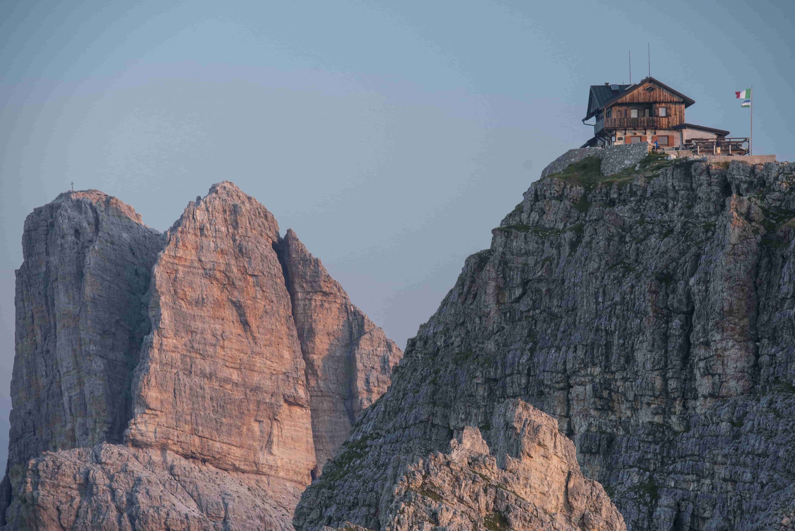
Rifugio Nuvolau
From the Rifugio Lagazuòi, follow path 20 and return to Forcella Lagazuòi, at 2,573 metres. Here, take path 401, which soon leads to the Forcella Travenànzes, at 2,507 m, from where you look out over the characteristic Val Travenànzes surrounded by austere peaks and famous walls streaked with a thousand colours. From the Forcella Travenànzes, you can descend directly and easily to the Passo Falzàrego via path 402 and from there continue on the Alta Via, but this would remove the option of passing over one of the most beautiful stretches. It is therefore advisable to continue north-eastwards on the northern side of Cima Falzàrego and Col dei Bòs, still on path 401-402, which is double numbered here, arriving at Forcella Col dei Bòs, at 2,331 m, at the foot of the famous and tragic rock fortress of Castelletto, famous for the heroic events of the 1915-18 war. Path 402 descends directly to Ra Nona, while a path climbs north-east towards the Castelletto and then onto the Ferrata Lipella. Take path 404 that runs under the beautiful wall of the Tofàna di Ròzes, offering a great panorama. Along this stretch you can visit the Grotta della Tofàna, which opens above an easily accessible jump (via ferrata kit and headlamp required). Continue on path 404 to the Valón de Tofàna at an altitude of 2,375 m at the junction with path 403, which goes from Rifugio Dibona up to Rifugio Giussani. With a clear diversions to the south, descend down path 403, zigzagging until it meets the small road that ends here and comes from the Dibona. It is not strictly necessary to reach the nearby Rifugio Angelo Dibona, at 2,037 m, but a visit to the establishment, reminiscent of the great Ampezzo guide, is strongly recommended. Private and cosy, open almost all year round with hotel and overnight accommodation with 65 beds. Mountain hut telephone number: +39 0436 86 0294. Email: [email protected]. From the small road above, take path 412, which leads back to the south west, passing under the bank of rocks that supports path 404 that’s just been taken. This section is also called Sótecòrdes in Ampezzo, meaning "under the ropes", just as the rocky cordon appears. The path continues fairly high, passes a shepherd's ruin and, at Rózes, at a height of 2,183 m, meets the military road that climbs towards Forcella Col de Bòs. Now, following both the road and some shortcuts, path 402 descends to the south west and touches State Road 48 of the Dolomites at Ra Nona (i.e. on the ninth bend in the road), at 1,985 m. Follow the State Road for about 300 metres southwards and, at a bend cutting through marshy terrain, take path 440 going south, then east and finally south-east through the Casonàte. The path is then fairly steep, basically in good condition. First through woodland, then through the Potór valley, it reaches the wide slab hump mixed with gravel, meagre pastureland and a dirt road north of Monte Averàu, a short distance from the Rifugio Scoiattoli, at 2,255 metres. You can avoid the small road (path 439) following path 440 to the south, which soon reaches Rifugio Averàu, at 2,413 m, near Forcella Nuvolàu. Following a good path along the sloping ridge of the mountain, climb to the scenic summit esplanade where the Rifugio Nuvolàu is located at 2,575 metres. The Rifugio Nuvolàu, owned by the Cortina d'Ampezzo Section of the CAI and built in 1883, is the first mountain hut in the Valle d’Ampezzo and stands on the belvedere of the peak of the same name. Exceptional stopover place both for its hospitality and the sunrises and sunsets. One of the most scenic and daring locations in the Dolomites, it is open from mid-June to mid-September and offers hotel service with 32 beds. Water available inside. Outside toilets. Lighting with generator. CNSAS "118" Rescue Station Mountain hut telephone number: +39 0436 86 79 38. Email: [email protected]
Rifugio Dibona, Rifugio Scoiattoli, Rifugio Averau, Rifugio Nuvolau
alleria del Castelletto: From Forcella Col dei Bòs, at 2,331 m, where path 402 descends to the south east and path 404 continue east, take the path that heads north-east and leads to the Galleria del Castelletto, a rocky outcrop famous for the events of the war. It formed the pillar of the Austrian defence towards Val Travenànzes and dominated the Italian positions in Val Costeàna. At 3am on 11 July 1916, the summit of the Castelletto was blown up with 35 tons of gelatine, causing the Austrians very heavy losses. The tunnel can be visited, with a lamp of course, by first passing a rocky wall equipped with wire ropes (the remains of a barrack), then entering the bowels of the mountain, which is zigzagged through with a height difference of 100 metres uphill and a development of about 500 metres, with the help of wooden steps and handrails. Various signs mark the different locations. Finally, you’ll emerge onto the wall a short distance from the explosion crater. Those wishing to continue on the Ferrata Lipella must proceed down the Val Travenànzes side along a long ledge to the beginning of the metal ropes. Those who want to return to the Alta Via 1 can follow a ledge and descend along a path, equipped with a metal rope, until it rejoins the path leading back to Forcella Col dei Bòs, from where it continues as indicated in the fourth stage.


Head Office: Loc. Sacus 4, 32043 Cortina d’Ampezzo (BL) – P.I. 00806650255 | Privacy Policy – Cookie Policy
A partire da giovedì 4 dicembre, ogni famiglia residente a Cortina potrà ritirare gratuitamente la bandiera con il nuovo emblema presso lo IAT di Piazza Roma.
Vivi la storia — sogna Milano‑Cortina.