For Experts
5 h
Lago Pianozes
Lago Pianozes
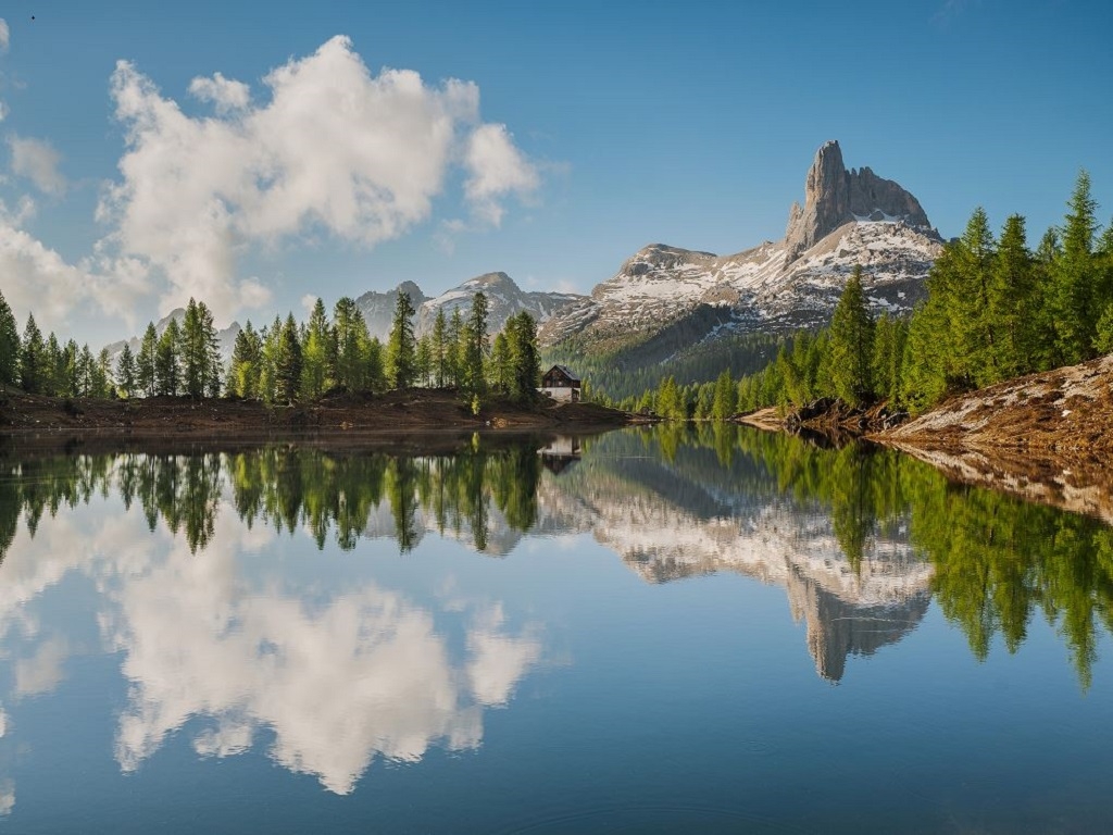
A hike of great naturalistic interest that passes through very different environments, including forests, alpine lakes, gorges and waterfalls. The Hike of Three Lakes hike was born thanks to the creation of the new Gores de Federa (Federa Gorge) path, created by the Regole d'Ampezzo: a ring-route of about five hours that lets you admire Lago di Pianozes, Lago d’Ajal and Lago Federa. The start is at the beautiful Lago Pianozes, an enchanting bright green lake surrounded by a dense forest, overlooked by the Chalet Pianozes, a renowned Ampezzo restaurant. After admiring the lake, return to the road, go up 100 metres and take the dirt road (path sign 430) in the direction of Lago d'Ajal, which can be reached in about 40 minutes on foot. The Lago d’Ajal is a wonderful little alpine lake, well-known for trout fishing. Go back 100 metres and take the challenging path 431, which, after passing the Cason de Cros del Macaròn, enters the forest, passing near the Beco d'Ajal: a magical place where a series of large boulders are surrounded by forest and the landscape is Tolkienesque. The area offers several points with an incredible viewpoint over the entire Valle d’Ampezzo: from the Tofane, to Pomagagnon, Cristallo, Faloria, Sorapis, up to Antelao. The area is also home to one of the most renowned sport climbing areas in Cortina. After an elevation gain of almost 1,000 metres and more than three hours of walking, the path leaves the forest and the view opens up to an exceptional panorama: you can admire the third lake on the route, the splendid Lago Federa, one of the most beautiful and famous mountain lakes in the Dolomites, overlooked by the Becco di Mezzodì, the Croda da Lago and the Rifugio Croda da Lago. This is the ideal place to take a break, admire the view and visit the mountain hut, which offers excellent cuisine. From the mountain hut, you can admire the valley on one side and the lake, hills and forest on the other. From here on, continue downhill, following dirt track 432, which leads to the Malga Federa in about 40 minutes. The mountain cottage is located in an enchanting spot, in the middle of a clearing surrounded by forest and then mountains, with a splendid view of the Valle d’Ampezzo: Croda da Lago and Becco di Mezzodì on one side, Pomagagnon, Cristallo and Faloria on the other. Here you’re sure to see cows, donkeys and horses grazing and you can stop to taste delicious local dishes. From the Malga, follow the signs for the new Gores de Federa path, a path that, between gentle climbs and descents, skirting waterfalls, gorges and streams of water and crossing five suspended bridges over the Ru Federa, leads in about 40 minutes to the Ponte di Federa. When you reach the bridge, continue along the road until you reach the start of path 428: this goes through a magnificent forest and rejoins path 430, from where you can return to the start of the loop path in about 45 minutes, without too much difficulty. Alternatively, you can continue along the main road to the starting point, shorter but less scenic.
Chalet Pianozes, RIfugio Lago d’Ajal, Rifugio Croda da Lago, Malga Federa
An alternative option allows you to shorten the route: once you have reached Lago Croda da Lago, you can descend by shuttle bus to Malga Federa or to Lago di Pianozes.


Head Office: Loc. Sacus 4, 32043 Cortina d’Ampezzo (BL) – P.I. 00806650255 | Privacy Policy – Cookie Policy
The Cortina Skyline is back!
Starting December 23, 2025, the lift system connecting Tofane, 5 Torri, and Falzarego will be back in operation.
A spectacular journey among the peaks, made possible by the synergy between Servizi Ampezzo S.r.l. and ISTA S.p.A.
Ready to touch the sky?