For Experts
3 hrs
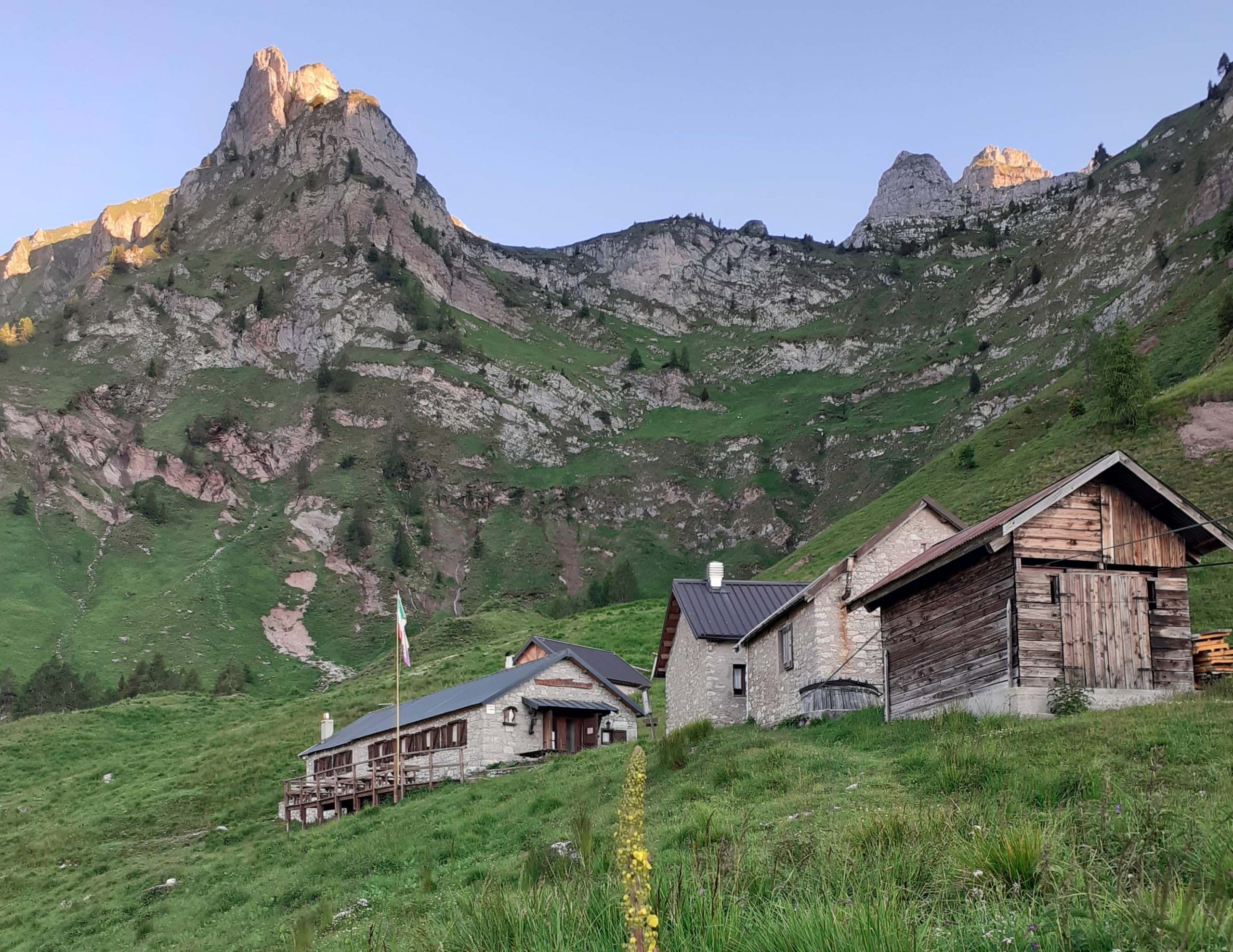
Rifugio Sommariva al Pramperét
Rifugio Pian de Fontana
From the Rifugio Sommariva to Pramperét, cross the Pra de la Vedova to the east for a while, then take the first path to the left (south-west), which bears the sign 514. The path climbs the bumps between the creeping pines and then cuts, higher up, the slopes of the eastern peak of the Balanzòle on the Pramperét slope. Having reached a gorge with strange slabs and small hollows, the path finally climbs up the pastureland slope to Portèla del Piazedèl, at 2,097 m, south of the rocks of the Cima Est de le Balanzòle. Now continue southwards on the slope of the Dante-esque Val Clusa and cross the Piazedìai through green oases and gravel stretches with paving stones, to the high esplanade with grassy and flowery clumps, gravel and small snowfields at the beginning of the season, called Vant dei Piazedìai, around 2,050 metres. From the Vant, cross southwards in the direction of the green ridge of the Baranción, then climb up through scree and clumps of rock, zigzagging, to a small gorge at an altitude of 2,330 m, from which the grandiose and wild Valón de los Erbàndoi appears. Then climb up the little ridge to a shoulder of grass, then again over stepped, not difficult rocks, from where a good level track cuts across the scree and reaches the Forcella Sud dei Van de Città, about 2,395 m. At this point, an impressive view opens up of the Van de Città, high, lunar-looking hollows of great, strange and severe beauty, certainly one of the most romantic locations in the mountains. Le Presón (Prisons), so called because of some "cells" hollowed out in the rock, divides the Van de Città (Zità) de entro from the Van de Città de fòra the Alta Via runs along the Van de fòra. From the pass, descend over meagre pastureland and easy slabs to the bottom of the Van, below the Forcella dei Erbàndoi, then descend a first step and touch the valley below, which you follow in a north-easterly direction to a grassy crag at an altitude of 2,030 m, below the Presón. Through a severe environment, rich in flora of all kinds, we finally descend via steep grassy crags (be careful if wet) to the Rifugio Pian de Fontana below and the adjoining "Renzo Dal Mas" bivouac, at 1,632 metres. 3 hours from Rifugio Sommariva al Pramperét. The Rifugio Pian de Fontana stands on the site of the old pastoral structure built in 1935. The mountain hut was built in 1993 and the bivouac in 1975, converted from an adjacent rural building. Owned by the Longarone Section of the CAI (Italian Alpine Club), it is open from mid-June to the end of September and offers hotel accommodation with 24 beds. The nearby "Renzo Dal Mas" bivouac, open during the winter, has 12 beds. Water available inside. Lighting with photovoltaics. Indoor and outdoor toilets with hot water and shower are available. CNSAS "118" Rescue Station Mountain hut telephone number: +39 0437 195 6135. Email: [email protected] Website: piandefontana.it.
Rifugio Pian de Fontana


Head Office: Loc. Sacus 4, 32043 Cortina d’Ampezzo (BL) – P.I. 00806650255 | Privacy Policy – Cookie Policy
A partire da giovedì 4 dicembre, ogni famiglia residente a Cortina potrà ritirare gratuitamente la bandiera con il nuovo emblema presso lo IAT di Piazza Roma.
Vivi la storia — sogna Milano‑Cortina.